Home
Streetwise Philadelphia Map - Laminated City Center Street Map of Philadelphia, Pennsylvania
Barnes and Noble
Loading Inventory...
Streetwise Philadelphia Map - Laminated City Center Street Map of Philadelphia, Pennsylvania in Bloomington, MN
Current price: $7.95

Streetwise Philadelphia Map - Laminated City Center Street Map of Philadelphia, Pennsylvania in Bloomington, MN
Current price: $7.95
Loading Inventory...
Size: OS
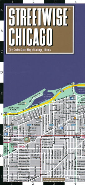
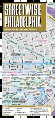
Streetwise Philadelphia Map
is a
laminated city center map
of Philadelphia, PA. The
accordion-fold pocket size travel map
has an integrated
Septa
metro map including lines, stations and bus map.
Coverage includes:
Main Philadelphia Map 1:14,000
Philadelphia Area Map 1:190,000
Philadelphia Independence National Historical Park Map 1:7,000
Philadelphia Transit Map
Center City Philadelphia Bus Map
Dimensions: 4" x 8.5" folded, 8.5" x 24" unfolded
Most people think that Philadelphia =
Liberty Bell
, but that's only the prologue. Yes, you can find the Bell,
Independence Hall
and the
Congress Hall
in
Independence National Park
, but venture further and you'll find hidden delights. For instance a few blocks away is
Elfreth's Alley
, the oldest residential street in America that is still home to families and professionals but reverts to its historic legacy with special events held throughout the year.
Reading Terminal Market
is a gastronomic payday, a giant public market that houses the most delicious offerings from around the region. And then there is cheesesteak perhaps one of the most passionate subjects in Philadelphia.
Looking at the STREETWISE® map of Philadelphia, you'll notice that the city is dissected by the Schuylkill and Delaware rivers. Between the Schuylkill and Delaware are the downtown business district, Independence Park, Philadelphia Museum of Art, Society Hill and Penn's Landing. The west side of the Schuylkill is University City where The University of Pennsylvania and Drexel University are located.
The STREETWISE® map of Philadelphia lays all this out for you and enables you to master the city and region. The insets on STREETWISE® Philadelphia Map include the Septa transit system and a Philadelphia Center City bus map. The expanded inset map of Independence Park will enable you to locate all the historic sites of Philadelphia. Use the Philadelphia Area Map to navigate throughout the Philadelphia area and the regions beyond. Find the Audubon Wildlife Sanctuary, or Philadelphia International Airport, or the Cherry Hill Mall. On an educational odyssey? Villanova, Bryn Mawr, and Swathmore College are only some of the temples of higher learning. A complete index of streets, hotels, points of interest, shopping, and parks is clearly listed.
The pocket size map of Philadelphia is laminated for durability and accordion folding for effortless use. For driving or to plan your trip to and from Philadelphia, use the
Michelin New England/Hudson Valley Road and Tourist Map No. 581.