Home
Remote Sensing and GIS Application in Flash Hazard Studies
Remote Sensing and GIS Application in Flash Hazard Studies
Current price: $66.85
Loading Inventory...
Size: OS
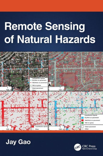
Natural Distastes are mostly occur in dry areas as a result of sudden climatic fluctuations. The flood is one of the most destructive environmental phenomena that cause severe damage and massive ruinous of infrastructure as well as material and life losses. The Geographical Information System (GIS) tools represents an affordable proposal for the establishment of the hydrological models based on analyzes of the spatial information, the integrated morphometric outputs, and the DEM that identifying runoff directions, drainage basins, and main sewers for the valleys to become an important input to the (SCS) model for the calculation of the flow of flash flood. Moreover remote sensing data represents one of the most important elements in Environmental Studies of floods disasters through monitoring the human activity and the evolution of their urban and agricultural activity depending on the satellite imageries for different years are applied to calculate the land use and monitor changes in land use). The previous elements are integrated with each other through geographic information systems and remote sensing techniques to vulnerability places