Home
Charleston, South Carolina Illustrated Map
Charleston, South Carolina Illustrated Map
Current price: $9.95
Loading Inventory...
Size: OS
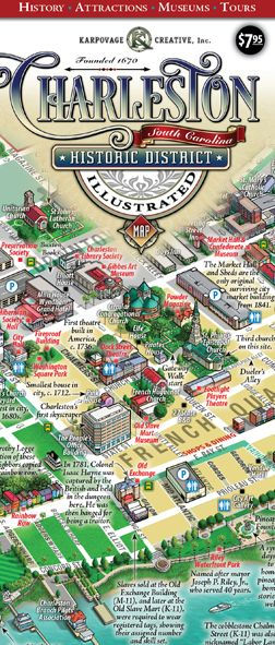
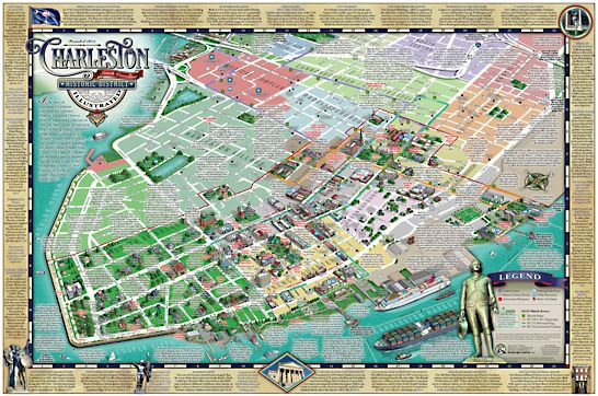
The Best Illustrated Map of Charleston's Historic District! This centuries-old artform depicts the heart of peninsular Charleston in a unique 3D birds-eye-view perspective. You'll see an immediate lay of the land showing the most popular visitor attractions and routes to get there. Essentially a tour guide for discerning visitors, this map is chock full of interesting historical factoids and useful information. We've included free DASH shuttles routes, water taxi locations, parking decks, hotels, and even public restrooms. Best of all, there are NO advertisements to distract you from your path. The map comes folded at 4x9-inches, perfect for a pocket or purse, and opens up into a vibrant 18x27-inch illustration.
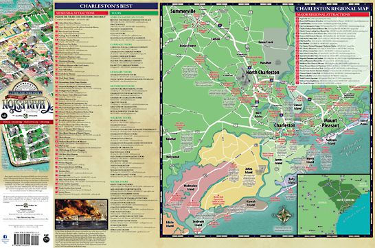
On the reverse side we've listed museums, attractions, and top guided tours. Included is a large regional map showing popular area attractions and the many coastal islands worthy of a visit. A guided walking tour with this map in hand is a must-do to get the most out of your stay in America's Most Friendly City.